Project News
2009-08-20
About the Alhajuela Lake Watershed
Today, I would like to explain about the "Alhajuela Lake watershed", which is in our Project title.
Panama's national territory can be largely divided into 52 watersheds. ANAM (National Environmental Authority) is the administrative institution that has the authority and responsibility to manage and conserve these watersheds.
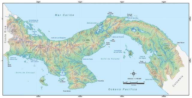
(Figure 1) Panama is divided into 52 watersheds and each has a corresponding number.
Among these is the Canal watershed, consisting of the rivers that flow into the Panama Canal, which is very important for the country. Therefore, its management and conservation is regulated by the constitution, and the Panama Canal Authority (ACP in Spanish) is specifically in charge of this watershed.
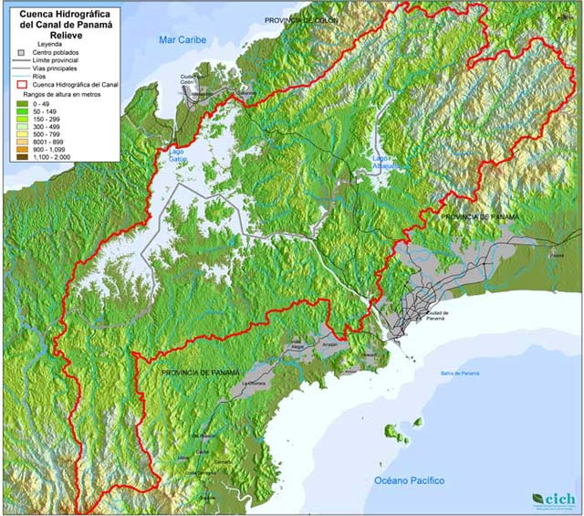
(Figure 2) The Panama Canal watershed. The large lake to the left is Gatun Lake, and the smaller lake in the center right is Alhajuela Lake. Both are artificial lakes created by dams.
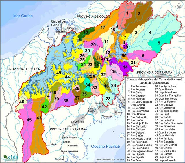
A large watershed can be divided into smaller "sub-watersheds" or "micro watersheds". The Alhajuela watershed is in fact a sub-watershed of the Panama Canal watershed, and is composed of the rivers that flow into Alhajuela Lake.
ANAM, together with other authorities, is part of the Panama Canal Watershed Inter-institutional Commission (CICH in Spanish) and participates in coordinating the projects, including our Project, that are carried out in the Canal watershed. When working in rural communities, we often use the term "micro-watershed" to identify the object area of the project activities. The Canal watershed has within it 50 micro-watersheds.
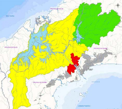
(Figure 3: left) The green area is the Alhajuela Lake sub-watershed.
(Figure 4: right) The 50 micro-watersheds that compose the Canal watershed.
(Source: Figure 1 is from ANAM; Figures 2-4 are from the CICH website)
(Mr. Taku MORI, Farmland Use Plan / Extension)