Outline of the Project
Project Name
Project for Building Disaster Resilient Societies in Central Region
Country
Vietnam
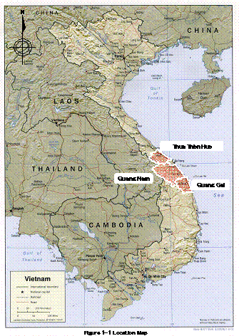
Project site
Tua Tien Hue, Quang Nam, Quang Ngai
Term of Cooperation
March 1, 2009 to February 28, 2012
Project Background
The Central Vietnam area is located in the tropical monsoon area. This area is vulnerable to rainfall related disasters because of heavy rainfall by tropical low pressure (typhoon) and the effects of central mountains along Laos. Further, run off time of rainfall is very short because the mountains and sea shore are very near. Because of such conditions, the down stream area is hit by sudden floods and the upper stream is hit by slope collapse and flash floods. It is anticipated that water related disasters from rainfall and floods will increase because of future climate change.
The government of Vietnam is taking measures such as dams, dikes and river protection to prevent such water related disasters. However still many disasters hit this area. Further, the Viet Nam government takes non structural measures such as relief and rescue activities, warning and evacuation. However, there are still many problems such as lack of knowledge and preparation of local residents and lack of communication systems etc.
Reflecting such a situation, the Vietnam government requested the Japanese government in 2007 to conduct a technical cooperation project to reduce water related disaster risks in central Vietnam aiming at community oriented to cooperation between central and regional governments and suitable for central Vietnam. Responding to this request JICA dispatched a preparatory study mission on June and August 2008.
Project Purpose and Output
Super goal
Measures against water-related disasters and adaptation to the increasing risk caused by climate change are strengthened.
Overall goal Measures against water-related disasters adapted to the exacerbating effects by global climate change are strengthened in Central Vietnam.
Project Purpose
Community-centered disaster management (CCDM) systems are strengthened in the project area.
The capacity of BNBNPMB to manage natural resources in the national park is enhanced through development of a co-management model at the target villages.
Outputs
- Organizational capacities of disaster management at provincial, district, and commune levels are developed.
- A manual for promoting CCDM is developed.
- Appropriate technologies of low-cost small-scale structural measures against river bank erosion are developed.
- MARD's supporting capacities in disaster management to local governments are developed.
Activities
| 1.1 | To formulate/update and monitor the action plans of provinces according to the national strategy for natural disaster prevention, response and mitigation to 2020 |
| 1.2 | To consolidate DMDs within Departments of Agriculture and Rural Development and make them effectively function |
| 1.3 | To strengthen the capacities of provincial committees of flood and storm control (CFSC) and district and commune CFSC of pilot sites. |
| 1.4 | To produce hazard maps on sediment disasters, floods, and bank erosion |
| 1.5 | To formulate intergrated flood management plans considering climate change effects |
| 1.6 | To improve early warning and evacuation systems |
| 2.1 | To select target communes and pilot sites (hamlets) |
| 2.2 | To evaluate existing coping mechanisms |
| 2.3 | To formulate plans of CCDM activities in pilot sites utilizing expertise of local universities and NGOs |
| 2.4 | To conduct activities of CCDM in collaboration with local universities and NGOs |
| 2.5 | To produce a manual for promoting CCDM, reflecting lessons and practices of pilot activities |
| 2.6 | To formulate CCDM promotion programs |
3.1 | To survey the conditions of candidate sites |
| 3.2 | To select two construction sites |
| 3.3 | To determine suitable low-cost small-scale works for each construction site, and implement the works |
| 3.4 | To evaluate the works and make necessary modifications |
| 3.5 | To produce Guidline for Riverbank Erosion Management |
| 4.1 | To improve institutional functions of disaster management of MARD |
| 4.2 | To review technical guidelines of countermeasures and submit them for approval |
| 4.3 | To plan training programs for local government officials in charge of disaster management, and produce training materials |
| 4.4 | To conduct training courses for disaster management for local governement officials in charge |
- About JICA
- News & Features
- Countries & Regions
- Our Work
- Thematic Issues
- Types of Assistance
- Partnerships with Other Development Partners
- Climate Change / Environmental and Social Considerations
- Evaluations
- Compliance and Anti-corruption
- Science and Technology Cooperation on Global Issues
- Research
- JICA Development Studies Program / JICA Chair
- Support for the Acceptance of Foreign HRs / Multicultural and Inclusive Community
- Publications
- Investor Relations