Completion of Hydrographic (or Marine) Survey of Honiara and Noro JICA and SIMA confirm the collaboration of Australia in JICA’s Technical Cooperation Project for the safety of navigation
2023.08.04

Japan International Cooperation Agency (JICA), and Solomon Islands Maritime Authority (SIMA), successfully completed a marine survey in Honiara and Noro on the 25th of July. JICA and SIMA confirm the collaboration of Australia to publish the Project outcomes quickly.
Hydrography is the branch of applied sciences which deals with the measurement and description of the physical features of oceans, seas, coastal areas, lakes and rivers, as well as with the prediction of their change over time. Hydrography is essential for the safety of navigation of large ships and small boats, allows ocean-based development, disaster risk reduction, environment protection and ensures Solomon Islands secures its maritime boundaries and benefits from its gigantic ocean area.
Since February last year, JICA and SIMA have been implementing “The Project for Development Support of Electronic Navigational Charts for Honiara and Noro Ports in Solomon Islands (SI ENC Project)” which produces high-quality navigational charts of Honiara and Noro for the safety of navigation in the area. The Project will produce precise Electronic Navigational Charts (ENCs) and paper charts based on a state-of-the-art hydrographic survey in the area.
On the 25th of July, the hydrographic surveys of Honiara and Noro were completed, which included the ports, the approaches to the two ports and the area from Noro to Munda through Diamond Narrows. In the hydrographic survey, the multi-beam echo sounder (MBES) was used, which measures the sea bottom profile in detail. 16 unknown sunken vessels have been discovered in Honiara, and the whole picture of Honiara’s sea bottom profile has been revealed for the first time. MBES has been used for the first time in Munda Bar and Blackett Strait and navigable channels have been clearly identified, contributing to safer navigation. On the 2nd of August, a Tripartite Meeting between JICA, SIMA and the Australian Hydrographic Office (AHO), Department of Defence was held to discuss the progress of the Project and JICA-AHO-SIMA close collaboration to produce ENCs and paper charts available to all mariners. They are expected to be published by AHO, the Primary Charting Authority (PCA) of Solomon Islands.
Mr. Yuki Morita, the officer in charge of the Project from JICA-HQ, commented that a good partnership between JICA and SIMA and the contribution of JICA Experts enabled us to reach the outcome gained so far. He also conveyed the importance of the AHO’s role in this project and his expectation for the AHO for its further engagement in this project closely.
Mr. Thierry Nervale, Director SIMA, stated when chairing the tripartite meeting “with this project, Solomon Islands is not only benefitting from the science and expertise in Japan and Australia but also get the best partnership together to shift to high-resolution charting in Solomon Islands, build SIMA’s capacity and systems, and embrace the future of marine science and technology for the safety, environment protection and economic development of Solomon Islands”.
Mr. Robert CARIO, the assistant director of International Charting Development at the Australian Hydrographic Office (AHO), says the AHO is proud to partner with Solomon Islands via a bilateral agreement on nautical charting and hydrography. As PCA, the AHO works closely with SIMA to produce and disseminate official nautical charts and publications. AHO currently maintains 17 SLB paper nautical charts and 43 ENCs as well as the Solomon Islands Annual National Tide Tables.
The AHO looks forward to ongoing collaboration and support to SIMA and JICA to ensure the production of new editions of nautical products encompassing recent JICA survey areas of Honiara, Noro, Blackett Strait and Munda which will greatly improve the nautical charting products which is crucial to mariner safety and the protection of Solomon Islands unique natural environment through safer navigation.
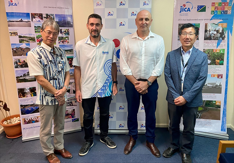
Tripartite Meeting with JICA, SIMA, AHO on 2nd August 2023
(From left to right: Mr. Takeshi WATANABE, Resident Representative of JICA Solomon Islands, Mr. Thierry NERVALE, Director of SIMA, Mr. Robert CARIO, Assistant Director of International Charting Development, AHO, Mr. Arata SENGOKU, Team Leader of JICA Consultant Team)
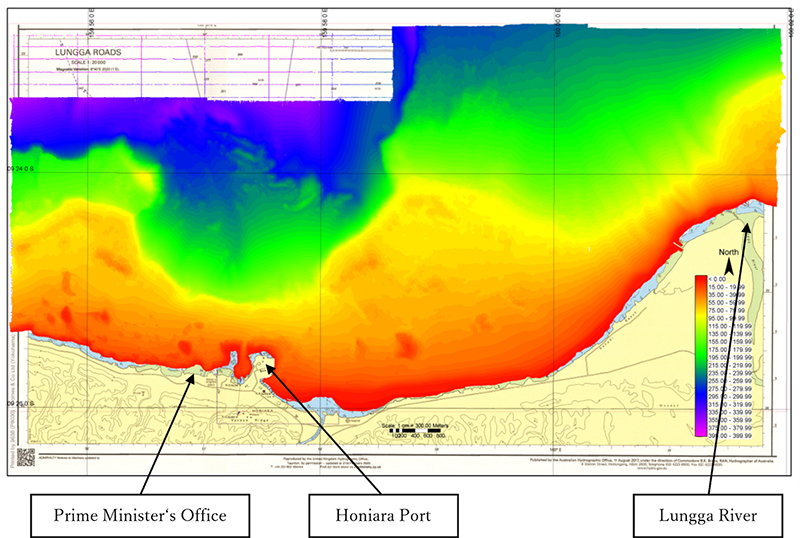
High-quality sea bottom topography of Honiara area by Multi-beam Echo Sounder
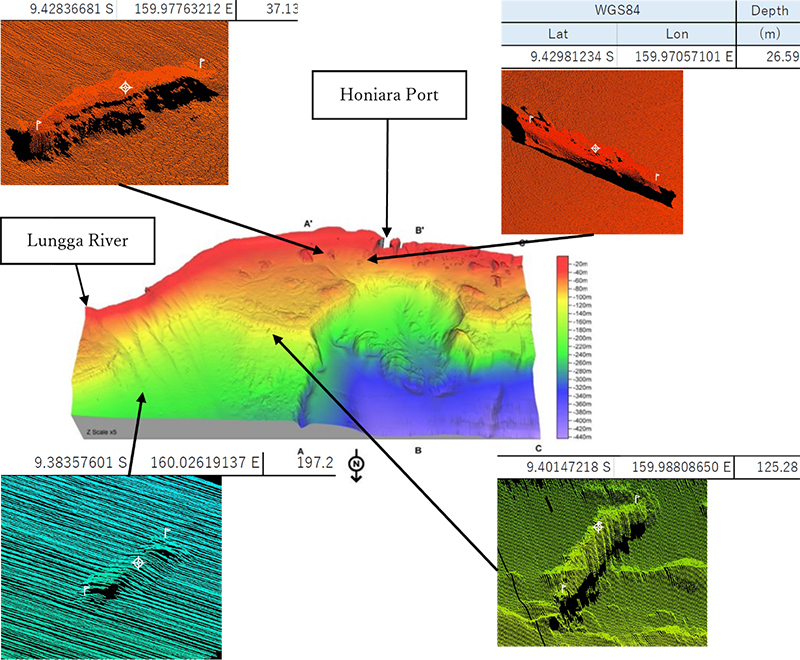
Place and Profile of wrecks with 3-D topography image at Honiara area
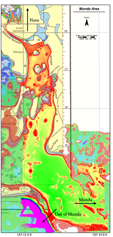
High-quality sea bottom topography at Munda area
Sns share!
scroll