Before the breakup of the Yugoslavia, maps were created and maintained by the geodetic bureau of the federal army, and the original plots were stored in Belgrade (where they remain today). Today, the former Yugoslav countries continue to use these maps, which date back to the 1970s, but they have not been able to revise them. The latest geographical information is indispensable for the promotion of development programmes at the national level, including infrastructure improvement, environmental preservation, and land use plans.
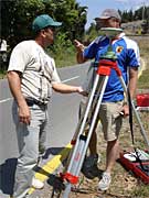
In response to a request from North Macedonia, JICA worked with counterpart staff to compile a digital map for one part of the country, which was designated a model area, made technology transfers, and undertook activities to make maps more widely available. Maps for the remaining parts of the country will be drawn up by counterparts and used for nation building.
Similar cooperation for map making is also provided to Bosnia and Herzegovina and Montenegro.
scroll