Hydrographic survey in Noro started on June 14 Joint effort by JICA and SIMA helps safety navigation in Noro Port, Blackett Strait and Munda Bar
2023.06.14

The hydrographic survey in Noro and the adjacent sea area under JICA’s Technical Cooperation project for Development Planning started on June 14 (Figure 1). It is jointly conducted by Aero Asahi Corporation (AAC), the project consultant contracted by JICA and the Solomon Islands Maritime Authority (SIMA) using SIMA’s working boat, which was substantially repaired last year by both JICA and SIMA.
JICA and SIMA jointly conducted the hydrographic survey in Honiara in 2022 and are now in Noro with the aim to produce Electronic Navigational Charts of Honiara and Noro areas in 2025. The Project started last year and is funded by JICA. The Project completed the hydrographic survey in Honiara in early June using state-of-the-art hydrographic equipment, which led to the discovery of 13 possible unknown wrecks in Honiara (Figure 2).
The hydrographic survey will reveal a detailed sea bottom profile of the approach of Noro, Noro Port and an extended area covering Diamond Narrows and Munda Bar providing precious maritime safety information. It will directly benefit nearby communities, small businesses and the safe movement of international and domestic ships and small boats around Munda, Noro and towards the high seas. Local ships and small boat operators as well as international vessel operators will be able to confidently choose Noro-Munda area for small business development, new marine tourism opportunities and international development projects in the Western region.
Mr. Takeshi WATANABE, the Resident Representative of JICA in Solomon Islands, remarked, “Noro is the second largest port of the Solomon Islands and plays a key role in the western part of the country. The hydrographic survey is highly anticipated by the Noro Harbour Master and other local stakeholders. The results are expected to contribute greatly to the safety and economic development of the region, including the establishment of a traffic separation scheme in Munda bar areas in the future.”
Mr. Thierry NERVALE, Director SIMA reiterated firm commitments to deliver the project, build SIMA’s capacity and benefit from JICA expertise. “This project is a game-changer for Solomon Islands. Not only it will provide to all on various devices high-resolution electronic information and imagery of the bottom of the sea, but it also opens doors to digital navigation in Solomon Islands. It is the first step to ensure the country and our coastal communities are not left behind and harness new technologies for their safety and development.”
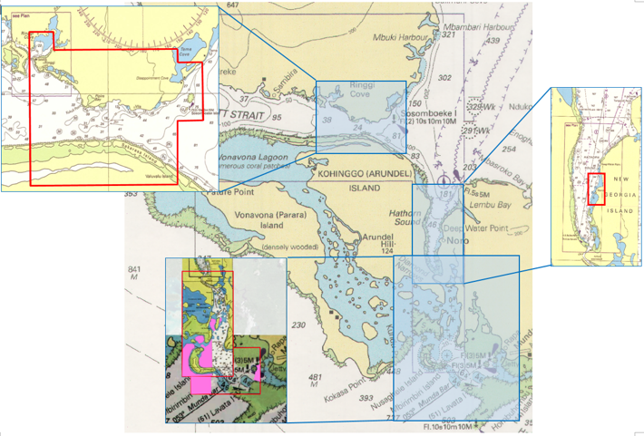
Figure 1. Project survey areas (shown in red) in Noro and adjacent sea area.
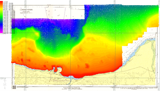
Figure 2. Sea bottom profile of Honiara obtained by the hydrographic survey in the Project. The Project succeeded in surveying the Honiara Sea area at an unprecedentedly high quality.
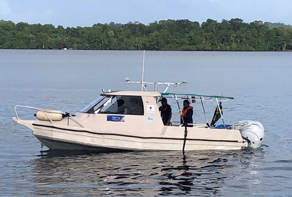
Figure 3. Hydrographic survey at Noro port area
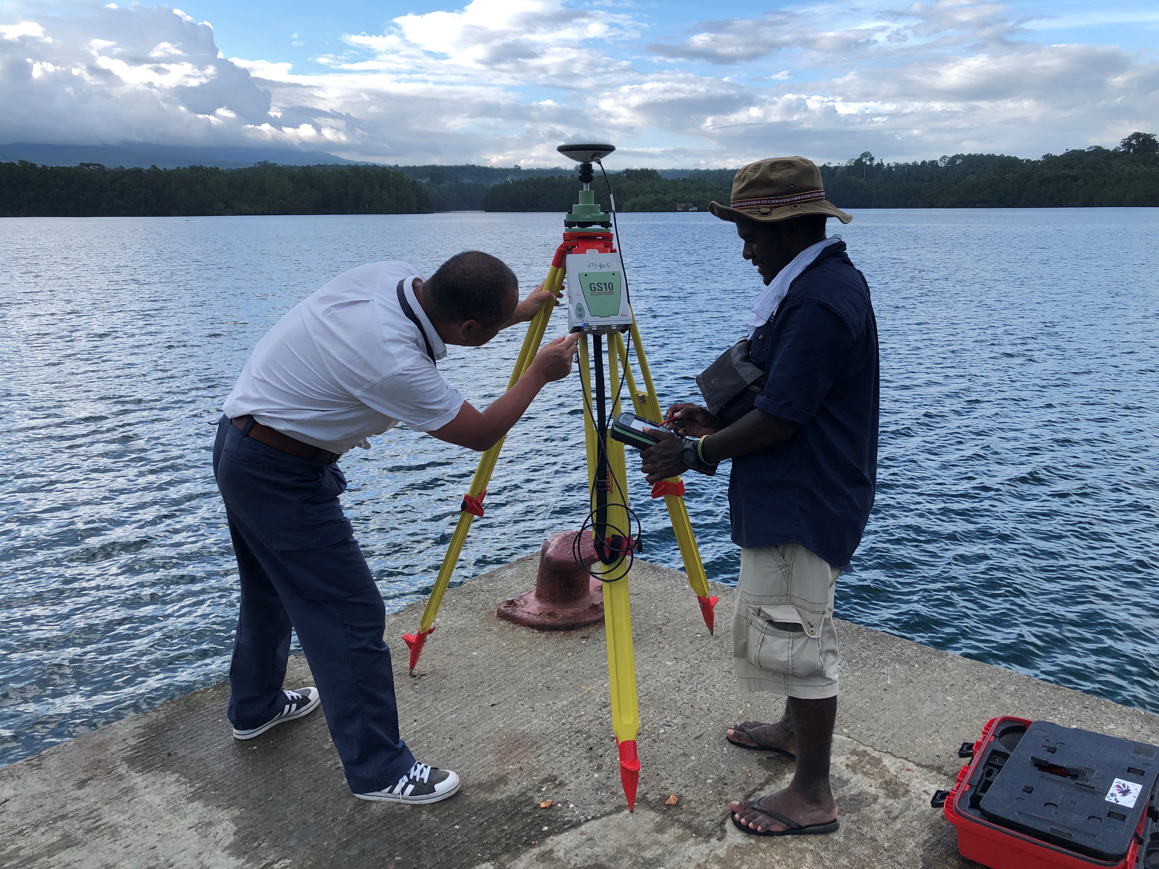
Figure 4. GNSS survey at Ringgi cove wharf
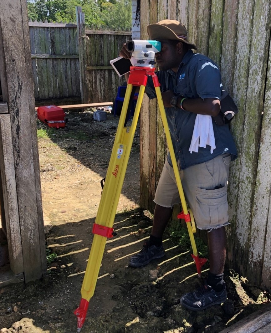
Figure 5. Levelling at Munda tidal station
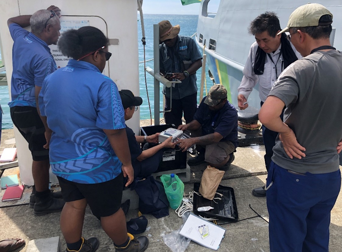
Figure 6. Tidal Observation at Honiara Tidal station
Sns share!
scroll