/english/about/dx/goodpractice/casestudy/__icsFiles/afieldfile/2023/09/19/top_casestudy_5.png
Satellite Data Used to Predict the Future of the Earth's Environment
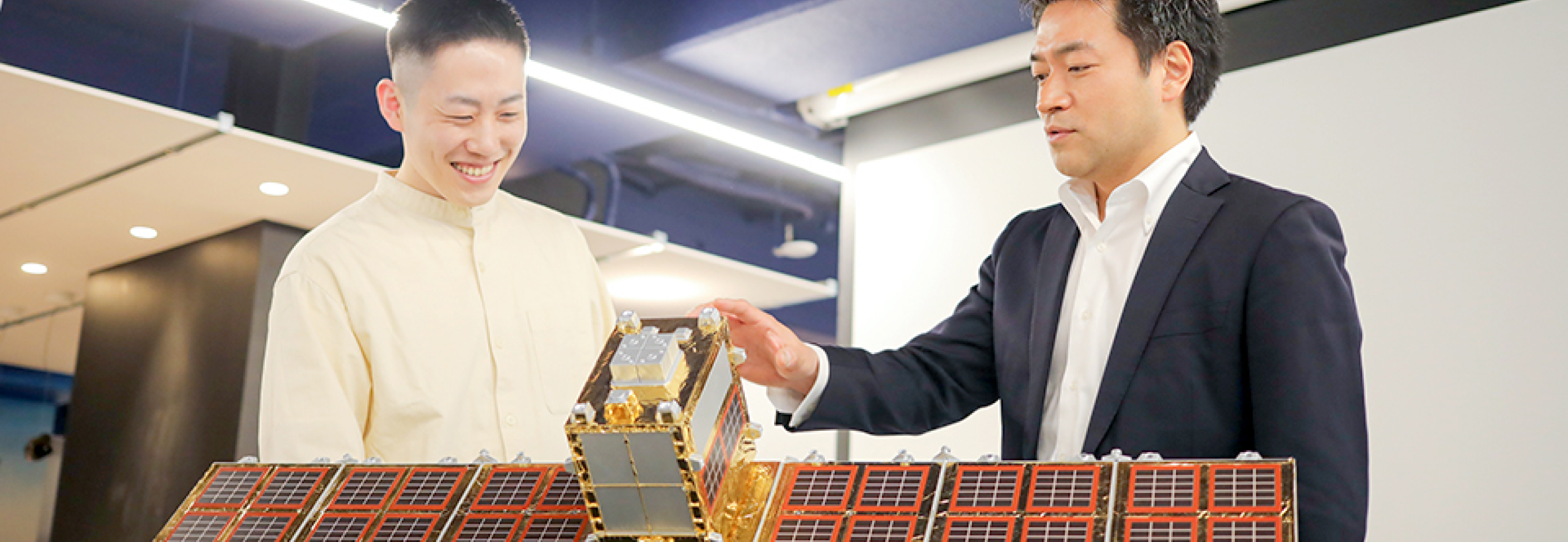
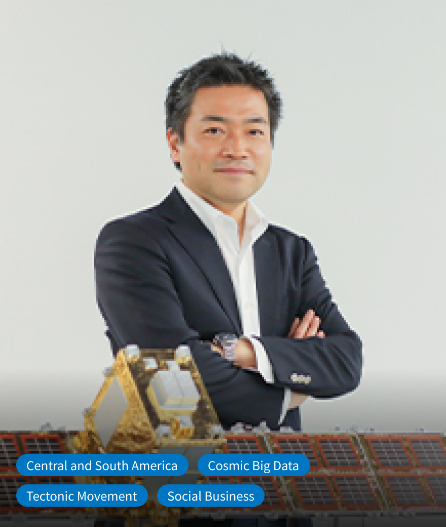
Synspective is a company that develops small Synthetic Aperture Radar (SAR) satellites. These satellites are the Earth Observation satellites with high frequency and resolution to provide solutions in the fields of disaster prevention, environmental and infrastructure management, and to help create a sustainable society. In the Central American country of Guatemala, where the risk of natural disasters such as earthquakes, floods, and landslides is significant, Synspective worked with JICA on a pilot project to monitor the land subsidence. Motoyuki Arai, Founder and CEO, and Jumpei Takami, who was responsible for the pilot project, described the company's collaboration with JICA, which has also contributed to the company's growth.
Summary
Project
Pilot Project “Introduction of SaaS-based ground displacement monitoring service in Guatemala” in “Information Collection and Verification Study on Development Cooperation in Central America and Caribbean Region With/Post COVID-19 Society”
Company
Synspective Inc.
Profile
In the pilot project in Guatemala, conducted in collaboration with JICA, Synspective used small SAR satellite data to analyze the historical land surface movement in the capital and its surrounding areas. This made it possible to discover potential ground deformation risks. The success of this project has spread to neighboring countries, and initiatives to utilize satellite data to cope with natural disasters and climate change are currently under consideration in the Central American and the Caribbean regions.
Index
- CHAPTER1 The Issue ~Accelerating the use of satellite data. The limitation of startups acting alone~
- CHAPTER2 Collaboration with JICA ~Spreading trust in technology from Guatemala to the Entire Central American and the Caribbean Region~
- CHAPTER3 Achievements ~Combining the goals of profitability and social impact offers great potential for working with public institutions~
Accelerating the use of satellite data. The limitation of startups acting alone
CHAPTER1 The Issue
“It's important to be moderately foolish and ignorant to launch a startup.”
Motoyuki Arai worked for a consulting firm and engaging in various social businesses in developing countries when he was approached by Professor Seiko Shirasaka of Keio University. Prof. Shirasaka was involved in the research and development of small synthetic aperture radar (SAR) satellites under the “ImPACT”
Program led by the Cabinet Office, and he asked Arai if he would like to collaborate on starting a business utilizing the small SAR satellite data.
Motoyuki Arai, CEO of Synspective
Arai was hesitant at first. He noticed that private companies were moving towards launching satellites, however, and the cost of analyzing satellite data was beginning to decline. He intuitively felt that the technology was solid, and it was worth taking the plunge. He founded Synspective in February 2018 and said “I took the leap into the space development industry despite not being familiar with the specialized field.”
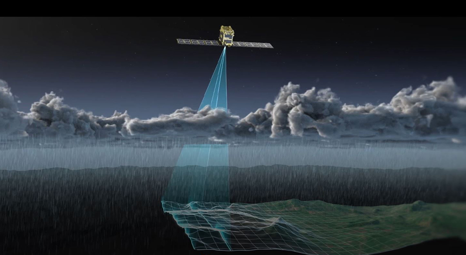
Illustration of a small SAR satellite under developing by Synspective. Using microwaves that penetrate clouds, the SAR satellite can monitor the Earth’s surface regardless of weather conditions or the time of day or night. It weighs approximately 100 kg and has a 5-meter-long antenna. Three small SAR satellites have been successfully launched so far.
Arai had a good idea of how to use satellite data for business based on his experience. While working on a renewable energy project in Saudi Arabia, he had learned that satellite data was effective for plant construction in the vast desert. He was also keenly aware of the need to use accurate data for creating plans and monitoring progress in developing countries. These thoughts are reflected in the company name, Synspective, which stands for “Synthetic Data for Perspective on Sustainable Development” – utilizing synthetic data for a sustainable future.
When satellite data is utilized in environmental fields such as natural disasters and infrastructure development, it often requires collaboration with public agencies. Even though Synspective was confident in the technology, it was difficult for a start-up with limited relationships with national and/or local governments to enter the market immediately. Still, Synspective was eager to use the technology to benefit society.
Synspective believes that mounting challenges can be solved by combining JICA’s long-standing trust with those governments and the company’s advanced private sector technology. Thus, the company made an offer to collaborate with JICA in Guatemala.
Spreading trust in technology from Guatemala to the Entire Central American and the Caribbean Region
CHAPTER2 Collaboration with JICA
The first project for Synspective and JICA focused on monitoring ground deformation in Guatemala, Central America. Like Japan, Guatemala is prone to earthquakes and landslides. It is necessary to respond quickly to the risk of land subsidence and landslides, yet there are few personnel available to conduct ground surveys. The response has previously been limited to analysis based on topographic data and rainfall information published by other organizations, and they have only conducted site visits after disasters happened.
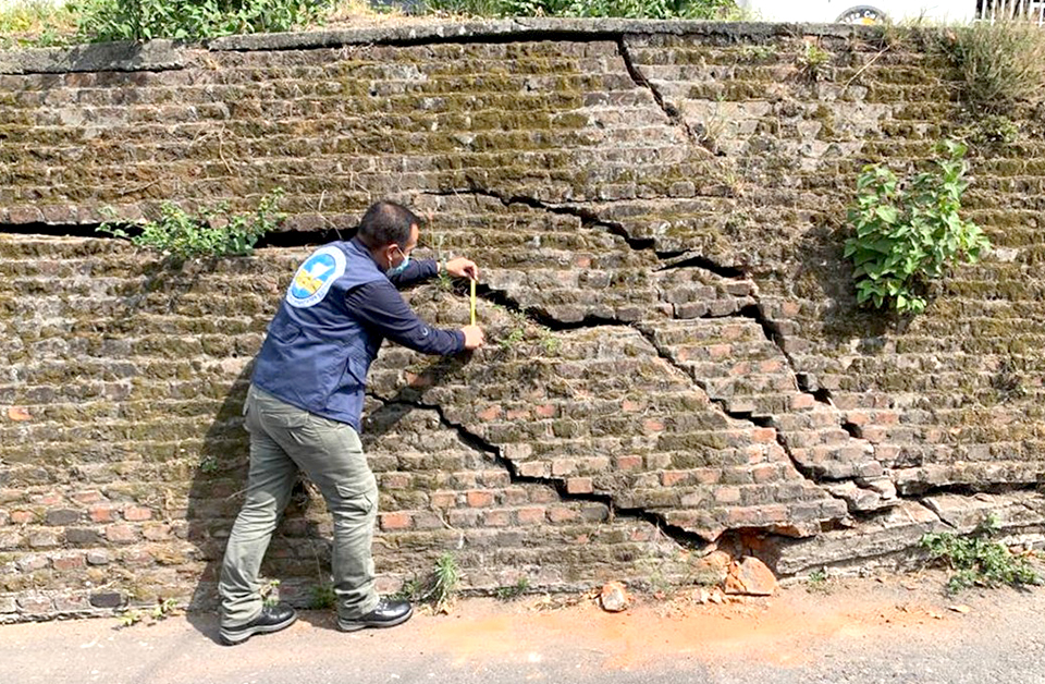
Cracks in a wall in Guatemala City, Guatemala, presumed to be caused by land subsidence
For this project, multiple SAR satellite data was used to monitor and analyze ground deformation in the capital city of Guatemala City and its suburbs for approximately three years (July 2018 to June 2021). The analysis of time-series deformation data at more than 1.4 million measurement points, mainly in urban areas, resulted in the discovery of three new potential subsidence risk locations that had not been recognized by survey agencies. In Guatemala City, Synspective estimated the statistical data for the whole Guatemala City to confirm the historical time-series land deformation. This ranged from approximately -292 mm at the point of maximum subsidence to +88 mm at the point of maximum uplift. The project showed that SAR technology can help with the early detection of potential ground deformation risks and the development of new disaster management systems. New surveying techniques can be provided to the agencies, and effectively and efficiently incorporated into their operations to protect the lives and property of the Guatemalan people.
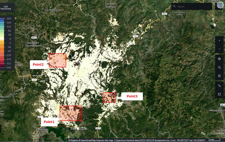
Web browser Screen of Synspective's Land Displacement Monitoring system, showing three new potential locations at risk of subsidence.
©Mapbox, ©OpenStreetMap Improve this map, ©Copernicus Sentinel data [2014 – 2021], ©Synspective Inc.
Though satellite remote sensing technology is already widely accepted in Japan, it was new to the Central Americans. Jumpei Takami recalls his surprise at the time when he got a question from the survey agency staff like whether the SAR satellite’s microwaves could be harmful for the human body. “The business started from a place where there was no awareness of these technologies,” he says.
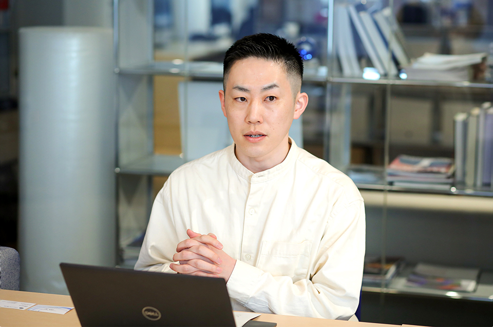
Jumpei Takami, project manager of JICA's pilot project in Guatemala
The local staff was carefully briefed on Synspective's solution services. The company uses satellite data to analyze ground deformation over a wide area, detect the amount of land surface deformation in millimeters, and provide map information as time-series data via a web browser. No matter how cutting-edge technology is, it has meaning only if it is established in the industry and accepted by society.
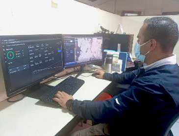
Staff of the Guatemalan surveying agency verifying analysis results
“JICA’s Guatemala office was a great help to us as we had to work online, unable to travel to the site due to the Pandemic,” Takami says. “The office provided us with a list of counterpart organizations to collaborate with for the project and support for communication. They also shared information on local inter-organizational relationships that could only be gathered from local sources, which helped us move the project forward smoothly.
Synspective primarily has focused on the Asian market, but the collaboration with JICA has led to the exploration of new markets. Based on its success in Guatemala, Synspective has joined JICA's TSUBASA program, an initiative to create new forms of development cooperation in Latin America and the Caribbean with Japanese startups that possess innovative ideas, business models, and technologies to achieve SDGs. Business possibilities for Synspective are also expanding to neighboring countries.
Combining the goals of profitability and social impact offers great potential for working with public institutions
CHAPTER3 Achievements
“Synspective's mission is to create a ‘learning world’ in which people are empowered through new data and technologies to maximize their capabilities and make tangible progress toward a more sustainable future,” says Motoyuki Arai. The “learning world” that he describes is a series of journeys that are data-driven (collecting and analyzing data to make judgments and decisions on various issues) and cultivate collective learning (learning collectively).
“I would like to create a platform where scientific data in various fields can be objectively analyzed and interpreted by anyone, where we can learn from each other with a wide variety of partners and realize a world of learning,” Arai says. “Even in a data-driven approach, understanding local issues solely through data can be difficult. In-person face-to-face relationships with trust and networks on the ground are essential.” For Synspective, working with JICA in Guatemala was a big step towards achieving this mission.
As the leader of a startup that also engages in social business activities, Arai aims to create a business model in which social issues are integrated into the economy and can be solved by combining profitability with the social impact of the company’s technology. “While we aim to be socially responsible, it is also important to make a profit,” he says. “As a business leader, I am trying to strike a balance between these two factors over time. We will work closely with public institutions in areas that take time but need to be established in society, such as research, technological development, and education.” Arai looks forward to further collaboration with JICA.
By the late 2030s, Synspective aims to complete a constellation of 30 satellites— a group of satellites working together as a system to observe with higher frequency—to monitor disasters in any part of the world in near-real time. According to Arai, the ultimate goal is to measure all aspects of the Earth's environment. “Based on the scientific data, we will be able to objectively analyze, rather than simulate, the economic activities of mankind in order to live comfortably on this planet.” The goal of Arai's vision of the future is already in sight.
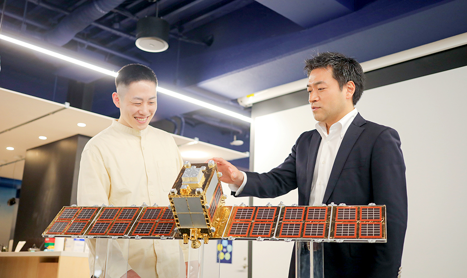
Motoyuki Arai (right) and Jumpei Takami with a 1:10 scale model of a small SAR satellite owned by Synspective. The time will soon come when they will be able to measure the earth from multiple angles using satellite data.
Comments from project member

Then Latin America Division, JICA Kazunaga Murakami
Countries in Latin America are constantly exposed to natural disasters, such as hurricanes and storm surge damage, landslides caused by heavy rain and flooding, and large-scale earthquakes. We believe that JICA can contribute to the improvement of comprehensive disaster prevention technology in such vulnerable regions by introducing innovative technologies. This will build on our existing efforts to improve disaster prevention capacity and promote pre-investment in disaster prevention.
The project with Synspective in Guatemala is an innovative initiative that should be highly commendable. Through the analysis of data collected using DX technology and satellite imagery, several new areas at high risk of land subsidence were identified, preventing potential accidents. JICA's Latin America Division is promoting these innovative initiatives under the slogan, “If you want to try something new, do it in Latin America.” So please keep an eye on our future developments.
JICA DXLab projects
- CASE STUDIES 4 Passion for Change! Poverty Reduction through a Unique Financial System
- CASE STUDIES 3 An Innovative Solution to the Global Water Crisis
- CASE STUDIES 2 From Kagawa, Saving Mothers and Children in Asia
- CASE STUDIES 1 A Revolution for a Billion People - Agri-tech Challenges in India
- DX Lab 1 Using AI to Detect Elephants Early and Promote Coexistence with Humans
- INTERVIEWS 3 Supporting Startups Aiming for Social Innovation in Developing Countries through Google's Accelerator Program
- INTERVIEWS 2 Challenge in Bhutan! Using Health Data to Promote People’s Health and Wellbeing
- INTERVIEWS 1 Roundtable: Telemedicine Startup × VC × JICA
If you're interested in co-creating with JICA, please contact us.