


scroll
JICA Intervention in Infrastructure Sector of Rwanda
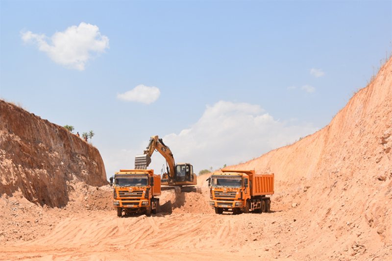
Ngoma Ramiro Road
Background
Rwanda is located in the Northern Corridor (logistic route from Mombasa port) and Central Corridor (logistic route from Dar Es salaam port). Road connection and custom clearance are critical for the logistics of the land locked country. JICA supports road projects which connect Northern Corridor to the Central Corridor which will contribute to socio-economic development, poverty reduction and regional integration between Uganda, Rwanda, Tanzania and D.R. Congo.
JICA’s Infrastructure sector is composed of three components including:
- 1 . Transportation (Urban/Rural),
- 2 . Energy,
- 3 . Trade Facilitation.
JICA has been contributing towards the improvement of road infrastructure and related operations through diversified projects including: The Project for Construction of Rusumo International Bridge and One Stop Border Post Facilities (Grand Aids, 2011-2014, 3.8 billion JPY), The Project on Capacity Development for Trade Facilitation and Border Control in East Africa (Regional Technical cooperation, 2009-2022) and Rusumo Kayonza Road Improvement Project (94km, Loan, 2018-2021, 6.8 billion JPY). These past projects and an ongoing road upgrading project below will strongly contribute to the further development of the corridor.
Urban transportation is also one of the focuses of JICA in Rwanda. Kigali, one of the fast-growing cities in Africa is expecting increase on the traffic volume due to the urbanization. Many policies have stated comprehensive goals on transportation to be implemented including Vision 2050, NST1 and Kigali City Master Plan. JICA is currently supporting counterparts on the implementation of the policies through technical cooperation projects below.
JICA Rwanda has been working on energy projects especially on the construction of substation and capacity building projects. The completed three substation projects have improved the efficiency of distribution network in Musha, Rwinkwavu, Ndera and Gasogi.
Ongoing projects
1. Ngoma Ramiro Road Upgrading Project
- Type of Cooperation: Loan project
- Duration: October 2021 to September 2024
- Target of the project: Pave the unpaved road between Ngoma- Ramiro (53km).
The project aims to upgrade the road between Ngoma and Ramiro which will form a deviation route from Rusumo border to Kigali. The current main route, passing from Rusumo to Kayonza and Rwamangana is overloaded as it cannot be widened due to the topography of the region.
This route will also give access for local people to reach Bugesera from the region thus helping them unlock job opportunities at the new international airport and industrial zone in Bugesera.
The road will have the connection to the project financed by the World Bank on the west side of Ramiro which reaches to Kibugabuga. This connection will further expand the corridor and connect to Democratic Republic of Congo and Republic of Burundi.
2. The Project for Urban Mobility Improvement in Kigali
- Type of Cooperation: Technical cooperation project
- Duration: April 2022 - March 2025
The project goal is to improve the transport mobility by building a mechanism to promote the use of the public transport in Kigali through proper traffic management. The project together with the counterparts have worked on conducting traffic survey and introduce transport information services for the efficient traffic control. The project conducts workshops in Rwanda and organizes training in Japan to share the knowledge and experience of development in Japan. Finally, the project will conduct pilot projects where the team will introduce small but efficient model on traffic control and public transportation to further develop the traffic management in the city.
3. The Project for Large Scale Mapping and Urban Mobility Improvement to Supply Infrastructure and Service in Kigali
- Type of Cooperation: Technical cooperation project
- Duration: April 2021 - March 2024
The project aims to build the capacity of the counterparts to produce an accurate large-scale topographic map by using Geographical Information Systems (GIS), Airborne and Satellite imagery and digital photogrammetry. The map and data will be utilized to realize effective urban planning and sustainable urban development of Kigali city.
The project improves the technical capacity of counterparts on map production and utilization including Aerial Photography Planning, GNSS Survey and GIS Data Utilization. Furthermore, the support of acquisition and using of Information Items for Road Asset management which will improve urban transportation. A training in Japan was also conducted to experience the systems and technologies to create and manage the large-scale mappings in Japan.