Project News
2019-02-28
Monthly Report for February 2019
Active Fault Mapping Training Course
From 9 February 2019, Mr Karma Namgay, a geologist with the Department of Geology and Mines (DGM), was at Hiroshima University to attend a two-week training course in active fault mapping. Under the supervision of Dr Takashi Nakata, Emeritus Professor of Hiroshima University, Karma learned how to interpret topography from aerial photos as well as how to carry out practical field geological exploration. After the course, Prof Nakata certified Karma's ability to interpret active faults from aerial photos. But to get a more advanced qualification, Karma has been assigned a lot of homework by Prof Nakata, including interpreting active faults from all existing aerial photos in Bhutan.
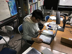 Karma reading aerial photos without stereoscopy
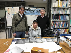 In a classroom at Hiroshima University
Maintaining the Seismometers
From 27 February 2019, a team drawn from the Department of Geology and Mines (DGM) and Kyoto University carried out maintenance on high-sensitivity seismometers on sites at an altitude of more than 4,000 m. They flew by helicopter to the two sites along the Himalayan mountain range, Jangothang and Thanza, and completed the maintenance within two days. During the works, they moved the observation sites slightly, replaced some instruments, and put in a mobile modem to improve the maintenance procedure.
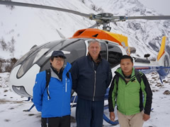 The team landed on Jangothang by helicopter
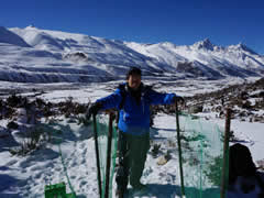 At a new observation site in Thanza
- About JICA
- News & Features
- Countries & Regions
- Our Work
- Thematic Issues
- Types of Assistance
- Partnerships with Other Development Partners
- Climate Change / Environmental and Social Considerations
- Evaluations
- Compliance and Anti-corruption
- Science and Technology Cooperation on Global Issues
- Research
- JICA Development Studies Program / JICA Chair
- Support for the Acceptance of Foreign HRs / Multicultural and Inclusive Community
- Publications
- Investor Relations