Gunung Merapi National Park
Location: There are two places for trials : ie. Ecosystems degraded by gravel extraction, the eruption of Mt. Merapi, and invasive species
Area: Ngablak Village Magelang District (40 Ha) and Mriyan Village Boyolali (20 Ha)
Ecosystem: Tropical Mountain Rain Forest
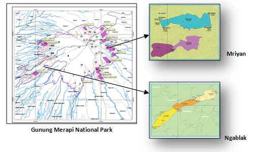 Restoration Trial Map at Gunung Merapi National Park
In the area of Gunung Merapi National Park, trials for restoration have been implemented, there are Ngablak Village, Magelang District and Mriyan Village, Boyolali District. The restoration of damaged ecosystems due to sand mining occurs at Ngablak area. A very thin soil is a challenge to test restoration at these locations. The restoration area will be 40 Ha, located at an altitude of 750 masl.
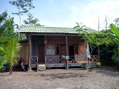 Pondok Jaga
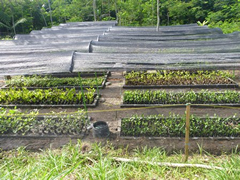 Nursery
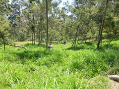 Planting site
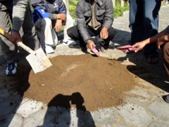 Working Group Training
Restoration areas in Mriyan are at an altitude of 1,300-1,700 masl. This location is covered by a lot of the exotic species, Acacia decurens. The following activitie have been implemented in the parnership between Gunung Merapi National Park Office and JICA:
- Survey and field study, for:
- The cause of damage,
- Condition of geography and vegetation,
- Composition of plants species, and
- Social economic condition of the target restoration areas.
- Establishment of a working group and implementation of the training,
- Construction of the nursery,
- Gathering of seed from National Park areas,
- Nursery operation,
- Identification of target restoration sites, and
- Implementation of restoration through assisted natural regeneration, enrichment planting, and planting
- About JICA
- News & Features
- Countries & Regions
- Our Work
- Thematic Issues
- Types of Assistance
- Partnerships with Other Development Partners
- Climate Change / Environmental and Social Considerations
- Evaluations
- Compliance and Anti-corruption
- Science and Technology Cooperation on Global Issues
- Research
- JICA Development Studies Program / JICA Chair
- Support for the Acceptance of Foreign HRs / Multicultural and Inclusive Community
- Publications
- Investor Relations