Project News
2011-09-11
Mt. Merapi site investigation
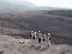 Site investigation at Gendol River
On September 11, 12, and 14, Sabo in Ministry of Land, Infrastructure, Transport and Tourism (MLIT) and other officials conducted a site investigation about the volume of pyroclastic flow deposits, debris flow, and the situation of change of bed, at the flowing rivers through Mt. Merapi, such as Gendol River, Bebeng River, and Putih River. For the site investigation, participants related to Yachiyo Engineering Co Ltd.,such as from Japan, Taro Uchida, Senior Researcher of Sabo Division of National Institute for Land and Infrastructure Management, Kinoshita Atsuhiko, The Manager of Quality Assurance Investigation of Rokko Sabo Office of Kinki Regional Development Bureau, Yoko Nakano and Hiroshi Kisa, Collaborating researcher of Volcano and Debris Flow Research Team, Public Works Research Institute, Yoshifumi Hara, Permanent Councilor and Director of International SABO Research Institute of Japan SABO Association, Kazuyuki Sato, Director of Planning, SABO Technical Center, Nobuo Anyouji, Director of Comprehensive Disaster Management, Ditto , Fumito Watanabe, Director of Planning and Investigation, Sabo Frontier Foundation, Toshiyasu Ueno, JICA Expert. From Indonesia, Hariyono Utomo, Head of Sabo Technical Centre, Ministry of Public Works.
The followings are the comments from participants that will help future plan:
- In order to seize the situation of the sediment transport and the change of bed, it is required to implement the wide area survey, and continuous observation of the sentinel. In addition, it is desirable to consider measures aiming to predict future changes in terrain.
- Due to the topical torrential rain in the region, it is difficult to carry out the rainfall observation. However, the rainfall is an important factor to determine the target planning. Thus, data collection is crucial.
- It is necessary to identify unstable sediment yield, in order to make the quantitative prediction on the targeted volume on the further planning.
- Concerning the study about the facilities placement planning, it is recommended to conduct adequate investigations of land use situation, and to use of numerical simulation.
- Not only facility development, but also dissemination activities on the prevention of sediment disaster towards residents, as well as development of warning and evacuation systems are required.
- About JICA
- News & Features
- Countries & Regions
- Our Work
- Thematic Issues
- Types of Assistance
- Partnerships with Other Development Partners
- Climate Change / Environmental and Social Considerations
- Evaluations
- Compliance and Anti-corruption
- Science and Technology Cooperation on Global Issues
- Research
- JICA Development Studies Program / JICA Chair
- Support for the Acceptance of Foreign HRs / Multicultural and Inclusive Community
- Publications
- Investor Relations